


¿Qué son los mapas multiespectrales 2D y 3D y por qué son tan valiosos?
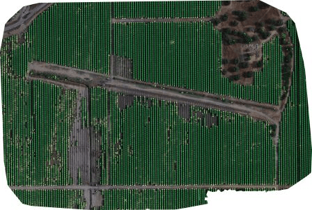
Los mapas multiespectrales 2D y 3D son una forma avanzada de captar datos más allá de la visión humana, ofreciendo vistas detalladas de la superficie terrestre. Cámaras especializadas recogen imágenes a través de varias longitudes de onda, incluido el infrarrojo y el infrarrojo cercano, revelando detalles invisibles a simple vista. Estos detalles, como la vegetación sana o las variaciones térmicas, se captan porque cada banda espectral se dirige a elementos específicos del terreno. Gracias a sofisticados procesos como la recogida de datos aéreos y la modelización digital, los mapas multiespectrales se han convertido en potentes herramientas para la ciencia, la gestión de recursos y la política. Salvan la distancia entre lo que vemos y los patrones ocultos de nuestro entorno, lo que representa un importante salto tecnológico en la comprensión de nuestro planeta. Su principal ventaja es una perspectiva multicapa, que ofrece perspectivas invisibles a simple vista. Esta potente tecnología es esencial para muchos campos. En agriculturaayuda a los agricultores a controlar la salud de los cultivos y a utilizar el agua de forma más eficiente. Para la conservación del medio ambiente, permite rastrear la deforestación y proteger nuestros bosques. En la planificación urbana, ayuda a identificar las zonas que atrapan el calor y orientar el desarrollo sostenible.
Esfuerzos previos, limitaciones y evolución en fotogrametría y teledetección
La fotogrametría y la teledetección llevan mucho tiempo siendo fundamentales para cartografiar y analizar la superficie terrestre. Los métodos tradicionales se basaban principalmente en técnicas fotográficas directas e imágenes básicas de satélite para recopilar información espacial. Los métodos existentes sentaron las bases para las aplicaciones medioambientales, pero tienen dificultades para captar los intrincados detalles necesarios para un análisis en profundidad. Esto dificulta nuestra capacidad para comprender plenamente los complejos problemas medioambientales.
Avances en las metodologías: SfM y MVS
- Limitación espectral - Los métodos fotográficos convencionales captan principalmente imágenes dentro del espectro visible, lo que limita la gama de variables medioambientales detectables. Muchos signos cruciales de la salud ambiental, como el estrés de las plantas, se vuelven más claros cuando miramos más allá de la luz visible. Estos signos se revelan a menudo en longitudes de onda no visibles, como los infrarrojos o los ultravioletas, que nuestros ojos no pueden detectar.
- Resolución espacial - Las primeras misiones por satélite solían proporcionar imágenes de baja resolución espacial, lo que dificultaba la detección de cambios medioambientales a pequeña escala. Esta limitación dificulta la detección activa de cambios ambientales sutiles. También dificulta la cartografía precisa de pequeños accidentes. Estas capacidades son esenciales tanto para la gestión medioambiental detallada como para la investigación científica.
- Resolución temporal - La frecuencia con la que se captan las imágenes por satélite tradicionales puede resultar insuficiente para vigilar los rápidos cambios medioambientales. Este retraso puede dificultar el análisis oportuno y la respuesta a acontecimientos como catástrofes naturales, cambios estacionales o un desarrollo urbano vertiginoso.
- Dimensionalidad - Los métodos fotográficos directos y las imágenes básicas de satélite tienen una capacidad limitada para captar la estructura tridimensional de paisajes y objetos. Esta limitación restringe la profundidad del análisis posible, sobre todo en aplicaciones como la silvicultura, la planificación urbana y los estudios geomorfológicos.
Limitaciones de los métodos tradicionales
Se reconocieron las limitaciones de los métodos tradicionales. La comunidad científica respondió adoptando SfM y MVS, metodologías más sofisticadas. Estos avances aportan mejoras sustanciales en la calidad y utilidad de los datos espaciales.
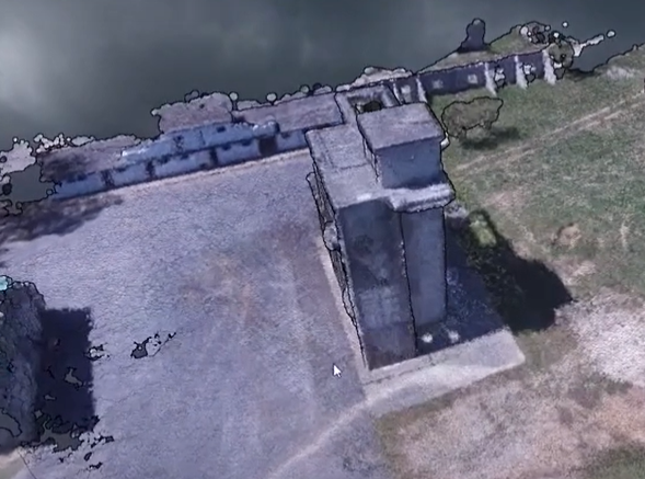
- Estructura a partir del movimiento (SfM) - La SfM es una técnica fotogramétrica que construye estructuras tridimensionales a partir de secuencias de imágenes bidimensionales. Mediante el análisis de múltiples fotografías tomadas desde distintos puntos de vista, los algoritmos SfM pueden deducir las coordenadas tridimensionales de los puntos de la superficie fotografiada. Este método no sólo mejora la resolución espacial, sino que introduce la dimensionalidad que falta en los métodos tradicionales, lo que permite crear modelos tridimensionales detallados del entorno.
- Estereopsis multivista (MVS) - Basándose en los principios de la SfM, la estereopsis multivista refina aún más el proceso de generación de modelos 3D utilizando imágenes captadas desde múltiples ángulos para reconstruir una escena. Las técnicas de MVS se centran en el análisis de la disparidad entre imágenes tomadas desde distintos puntos de vista para estimar la profundidad, lo que mejora notablemente la precisión y el detalle de los modelos 3D producidos.
Tanto la SfM como la MVS representan avances significativos en nuestra capacidad para generar mapas y modelos multidimensionales, precisos y de alta resolución de la superficie terrestre. Las nuevas metodologías superan muchas limitaciones de las técnicas tradicionales de fotogrametría y teledetección. Este avance abre nuevas posibilidades de análisis medioambiental en profundidad. Gracias a estos métodos, los científicos e investigadores pueden explorar y comprender la compleja dinámica de los entornos naturales y construidos. ¿Cuál es el resultado? Una claridad y un detalle sin precedentes.
Metodología de generación de mapas multiespectrales
La generación de mapas multiespectrales 2D y 3D se basa en una metodología cuidadosamente estructurada. Este método implica en primer lugar una serie de procedimientos. Estos procedimientos integran a la perfección técnicas avanzadas de obtención de imágenes con un sofisticado procesamiento de datos. En última instancia, este proceso traduce las imágenes aéreas en representaciones detalladas y multidimensionales de la superficie terrestre. A continuación se indican los pasos:
Carga/introducción de datos
Las plataformas aerotransportadas equipadas con sensores de imagen recogen imágenes aéreas. Estas imágenes constituyen el primer paso crucial en la creación de mapas multiespectrales 2D y 3D, que captan la superficie de la Tierra con todo detalle. Esta etapa es decisiva para recopilar datos brutos, que constituyen la base de todos los análisis y modelizaciones posteriores.
Estructura a partir del movimiento (SfM)
La transición de la fase de carga/introducción de datos a la fase de estructura a partir del movimiento (SfM) en la creación de mapas multiespectrales es una progresión fluida que depende de la preparación y organización sistemática de las imágenes aéreas recopiladas. Esta transición se facilita mediante una serie de acciones y análisis interconectados que preparan el conjunto de datos para un modelado 3D complejo.
- Extracción de metadatos - Este es el paso inicial de la SfM, en el que se extraen de cada imagen los metadatos pertinentes (por ejemplo, coordenadas GPS, orientación de la cámara). Esta información es crucial para el posicionamiento y la orientación precisos en el proceso de reconstrucción posterior.
- Detección de características - Se emplean algoritmos para detectar características visuales distintivas dentro de las imágenes, como bordes o texturas específicas, que son fundamentales para el emparejamiento y el seguimiento a través de múltiples imágenes.
- Coincidencia de características - Este paso consiste en identificar y emparejar características similares detectadas en distintas imágenes. El emparejamiento correcto de características es esencial para reconstruir con precisión la escena en 3D.
- Creación de pistas - Aquí se desarrollan secuencias o "pistas" de características coincidentes a través de múltiples imágenes. Estas pistas ayudan a comprender el movimiento y la estructura de la escena y sirven de guía para el proceso de reconstrucción 3D.
- Reconstrucción - Utilizando las pistas de características como referencias, se monta un modelo 3D disperso de la escena. Este modelo representa la reconstrucción inicial, menos densa, de la geometría de la escena.
- Undistort - Antes de la densificación, se corrige cualquier distorsión presente en las imágenes (normalmente causada por el objetivo de la cámara). Este paso garantiza que las imágenes reflejen con precisión las formas y tamaños reales de los objetos de la escena.
Vista múltiple estéreo (MVS)
- Selección del par estéreo - En el proceso MVS, se seleccionan pares de imágenes en función de su idoneidad para el análisis de profundidad. Esta selección se guía por el solapamiento y los ángulos entre imágenes para maximizar la extracción de información de profundidad.
- Estimación del mapa de profundidad - Para cada par (o conjunto) de imágenes seleccionadas, se estiman mapas de profundidad que detallan la distancia de las superficies desde la perspectiva de la cámara.
- Filtrado de mapas de profundidad - Los mapas de profundidad estimados se someten a un filtrado para eliminar el ruido y mejorar la precisión, garantizando que sólo se conserve la información de profundidad fiable.
- Fusión de mapas de profundidad - A continuación, los mapas de profundidad refinados de las distintas vistas se fusionan en un único modelo de profundidad coherente. Este modelo proporciona una representación más detallada y precisa de la geometría de la escena.
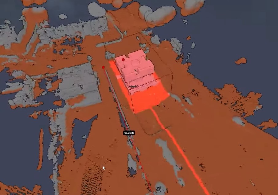
Reconstrucción de mallas
Tras el proceso MVS, tiene lugar la transformación detallada desde las definiciones de funciones espaciales hasta la extracción de isosuperficies. Este paso crea una representación de malla del modelo, añadiendo detalles de superficie y texturas al modelo de profundidad previamente construido.
Los procesos SfM y MVS, junto con la reconstrucción de mallas, crean conjuntamente un flujo de trabajo que transforma conjuntos de imágenes aéreas en modelos 3D detallados y texturizados.Este enfoque combina dos tipos de información para crear reconstrucciones de escenas de gran precisión. Utiliza datos geométricos de imágenes individuales y datos de profundidad obtenidos mediante el análisis de pares de imágenes.
Reconstrucción de mallas
Tras el proceso MVS, tiene lugar la transformación detallada desde las definiciones de funciones espaciales hasta la extracción de isosuperficies. Este paso crea una representación de malla del modelo, añadiendo detalles de superficie y texturas al modelo de profundidad previamente construido.
Los procesos SfM y MVS, junto con la reconstrucción de mallas, crean conjuntamente un flujo de trabajo que transforma conjuntos de imágenes aéreas en modelos 3D detallados y texturizados. Este avanzado método combina las formas de imágenes individuales con datos de profundidad de pares de imágenes. El resultado son modelos 3D increíblemente precisos de la escena fotografiada.

Reconstrucción de texturas
Tras la creación de un modelo 3D mediante SfM, MVS y la reconstrucción de mallas, la reconstrucción de texturas es el proceso que da vida al modelo añadiendo detalles realistas a la superficie.
- Preprocesamiento - Tras la creación de un modelo 3D mediante SfM, MVS y la reconstrucción de mallas, la reconstrucción de texturas es el proceso que da vida al modelo añadiendo detalles realistas a la superficie.
- Ver selección -Determina las imágenes o perspectivas más adecuadas para aplicar texturas al modelo 3D. Este paso es crucial para optimizar la calidad visual del modelo, garantizando que las texturas se apliquen desde ángulos que minimicen la distorsión y cubran el modelo de manera uniforme.
- Ajuste del color - Ajusta los colores de las texturas derivadas de las imágenes aéreas para que coincidan con el aspecto real del terreno y sus características. Este paso aborda cualquier discrepancia en el color que pueda surgir de la variación de las condiciones de iluminación o de los ajustes de la cámara durante el proceso de captura de imágenes, mejorando el realismo del modelo texturizado.
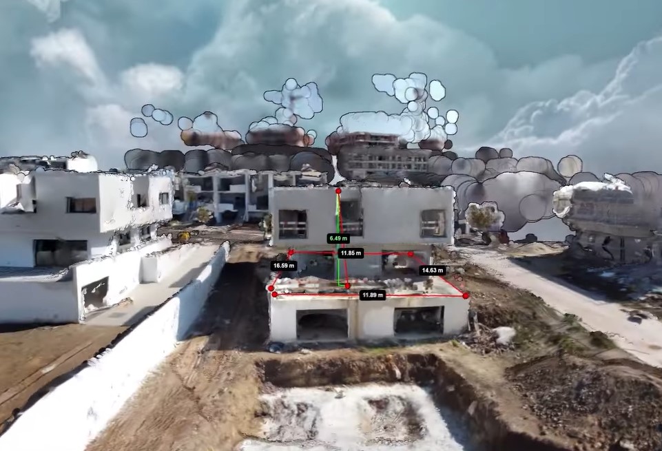
Georreferenciación
La georreferenciación es el proceso de alineación del modelo 3D texturizado con las coordenadas geográficas del mundo real, crucial para garantizar que el modelo representa con precisión la ubicación física y la orientación de la zona estudiada.
Alinear el modelo garantiza que se ajuste a las ubicaciones del mundo real, lo que lo hace compatible con otros datos geográficos. De este modo se aprovecha su potencial para usos prácticos como la planificación urbana, la vigilancia medioambiental y la navegación.
Creación de ortomapas
- Ortomapa - Proporciona una vista aérea de la zona estudiada, aplanando el modelo 3D en un mapa 2D y manteniendo al mismo tiempo la precisión espacial de las características. Este mapa es útil para una amplia gama de aplicaciones que requieren imágenes precisas de arriba abajo, como la planificación del uso del suelo, la gestión de activos y el análisis geográfico.
Resultados experimentales: Aplicaciones prácticas y retos
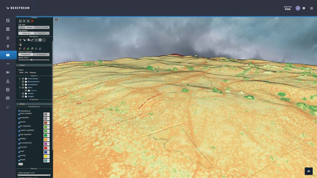
El método esbozado para mapas multiespectrales 2D y 3D, utilizando datos RGB, multiespectrales y térmicos, ha mostrado importantes mejoras en la vigilancia medioambiental, la agricultura y la planificación urbana. La aplicación de un flujo de trabajo completo de recopilación de datos, SfM, MVS, texturización y georreferenciación produjo modelos detallados y precisos del paisaje. Estos modelos sirven para múltiples propósitos, desde la evaluación de la salud de los cultivos y las necesidades de riego en la agricultura hasta la mejora de los estudios de las islas de calor urbanas y los esfuerzos de conservación del medio ambiente.
Retos y soluciones
La aplicación de esta metodología nos planteó algunos retos. Entre ellos, el manejo de una cantidad ingente de datos, la precisión de los modelos 3D y la complejidad de las imágenes térmicas. A continuación se analizan estos problemas y las soluciones aplicadas para resolverlos:
Volumen de datos y tiempo de procesamiento:
Desafío: Las imágenes aéreas de alta resolución para mapas detallados en 2D y 3D requieren una enorme cantidad de datos. Esto pone a prueba la capacidad de procesamiento de los ordenadores, lo que se traduce en largos tiempos de espera para crear los mapas.
Solución: Se aplicaron técnicas de optimización para agilizar el procesamiento de datos, incluido el procesamiento paralelo y los recursos informáticos en la nube. Además, se perfeccionaron los algoritmos para gestionar y procesar eficientemente grandes conjuntos de datos, reduciendo eficazmente el tiempo necesario para la generación de modelos.
Precisión de los modelos 3D:
Reto: Garantizar la precisión espacial de los modelos 3D, especialmente en entornos complejos con terreno y vegetación diversos, resultó ser un obstáculo considerable.
Solución: Se emplearon métodos de calibración mejorados y algoritmos avanzados de correspondencia de características para mejorar la precisión de las reconstrucciones 3D. La integración de puntos de control terrestre (GCP) y una rigurosa validación posterior al procesamiento también contribuyeron a alcanzar altos niveles de precisión del modelo.
Integración de imágenes térmicas:
Reto: La incorporación de imágenes térmicas al proceso de cartografía multiespectral supuso un reto debido al bajo contraste y a la ausencia de rasgos característicos de las imágenes térmicas, lo que dificultó la detección y el cotejo de rasgos.
Solución: Para mejorar la visibilidad de las características en las imágenes térmicas, por ejemplo, como se ve en nuestro gestión sostenible de los recursos vitícolas de investigación, desarrollamos pasos especializados de preprocesamiento. A continuación, adoptamos un enfoque híbrido, combinando datos térmicos con imágenes RGB y multiespectrales para aprovechar al máximo los puntos fuertes de cada tipo. Este enfoque nos permitió integrar con éxito la información térmica en mapas multiespectrales, revelando información valiosa sobre las variaciones de temperatura y las fuentes de calor.
Condiciones ambientales y variabilidad de la iluminación:
Desafío: La variación de las condiciones de iluminación y los factores ambientales, como la nubosidad y las sombras, afectaban a la coherencia y la calidad de las imágenes aéreas.
Solución: Se llevó a cabo una planificación estratégica de las misiones de recogida de datos para que coincidieran con las condiciones óptimas de iluminación y meteorología. Cuando las incoherencias fueron inevitables, se aplicaron técnicas avanzadas de procesamiento de imágenes, incluidas la calibración radiométrica y la compensación de sombras, para normalizar los datos.
Implicaciones de los resultados experimentales
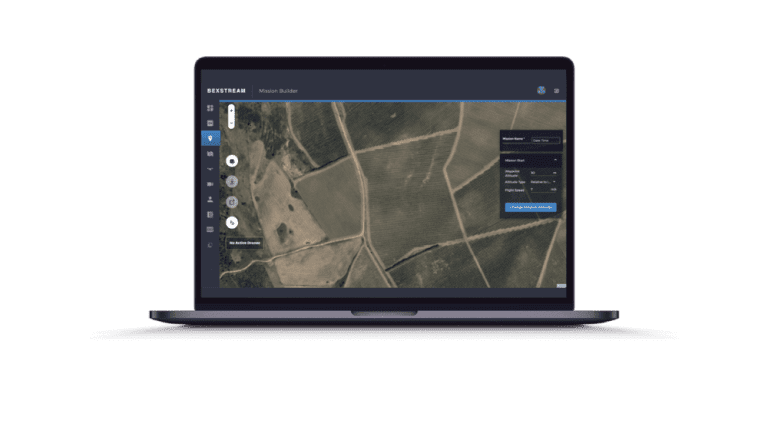
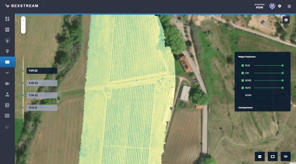
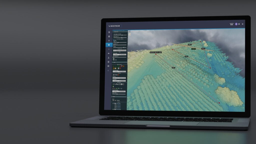
Los experimentos ponen de relieve el poder de los mapas multiespectrales para comprender nuestro mundo. Estos datos detallados, adquiridos mediante técnicas avanzadas, abren puertas al análisis medioambiental, la optimización de la agricultura y la planificación urbana sostenible. Al captar más allá del espectro visible, estos mapas revelan conocimientos cruciales para vigilar los ecosistemas, gestionar el agua y planificar ciudades sostenibles. La versatilidad de estos mapas, capturados con beXStream control remoto de drones basado en la nube, subraya su valor en diversos campos, desde la detección de cambios sutiles en la vegetación hasta la identificación de firmas de calor en zonas urbanas.
Eficacia de las metodologías adoptadas
Las metodologías empleadas en este estudio, en particular las adaptadas del flujo de trabajo de OpenDroneMap, han demostrado ser muy eficaces para generar mapas multiespectrales precisos y detallados. La integración de las técnicas Structure from Motion (SfM) y Multi-View Stereo (MVS), junto con procesos avanzados de texturización y georreferenciación, facilitó la creación de modelos 3D de alta resolución a partir de imágenes aéreas. El éxito de la aplicación de estas metodologías subraya la importancia de un enfoque global e integrado del tratamiento de datos en teledetección. Al aprovechar las herramientas de código abierto de OpenDroneMap, el estudio se benefició de una plataforma robusta y apoyada por la comunidad, lo que permitió el procesamiento eficiente de grandes conjuntos de datos y la producción de modelos espaciales altamente detallados. Esta validación del flujo de trabajo de OpenDroneMap en el contexto de la cartografía multiespectral pone de relieve su potencial como herramienta valiosa para investigadores y profesionales del sector.
Futuras líneas de investigación y aplicación
El campo de la cartografía aérea multiespectral está a punto de experimentar grandes avances. La investigación futura podría perfeccionar los algoritmos de procesamiento de datos, sobre todo en proyectos a gran escala, para aumentar la velocidad y la precisión de la generación de modelos. Además, la integración del aprendizaje automático y la IA podría ofrecer nuevos métodos de detección y clasificación de características, lo que podría automatizar partes del proceso y revelar patrones ocultos. Además, la exploración de diversas fuentes de datos, como los datos LiDAR y SAR, podría mejorar las capacidades de análisis multidimensional de los mapas multiespectrales 2D y 3D. En cuanto a las aplicaciones, la cartografía multiespectral encierra un enorme potencial para contribuir a la investigación del cambio climático, la planificación de la respuesta ante catástrofes y la conservación de la biodiversidad, entre otros apremiantes retos mundiales. A medida que evolucionen la tecnología y las metodologías, también lo harán sus aplicaciones, prometiendo perspectivas más ricas y soluciones más eficaces para diversos problemas medioambientales y sociales.
Puntos clave
-
Importancia de evitar las colisiones
- Los mapas multiespectrales son herramientas avanzadas que captan datos a través de múltiples longitudes de onda, revelando intrincados detalles sobre la superficie terrestre invisibles a simple vista.
- Su valor reside en aplicaciones como la gestión agrícola, la conservación del medio ambiente y la planificación urbana. -
Limitations of Traditional Photogrammetry & Remote Sensing
- Los métodos tradicionales estaban limitados por la resolución espectral, espacial y temporal, y por la dimensionalidad, lo que afectaba a la profundidad del análisis medioambiental.
-
Avances en las metodologías - SfM y MVS
- Las metodologías Structure from Motion (SfM) y Multi-View Stereopsis (MVS) ofrecen mejoras significativas en la generación de modelos 3D precisos y de alta resolución. -
Metodología de generación de mapas multiespectrales
- El proceso incluye la recopilación de datos, el modelado tridimensional (SfM), el análisis de profundidad (MVS), la reconstrucción de mallas para crear una representación de las mismas y la reconstrucción de texturas para añadir detalles a la superficie. -
Experimental Results & Challenges
- Se destacaron las aplicaciones en la vigilancia del medio ambiente, la agricultura y la planificación urbana, junto con retos como el volumen de datos, la precisión de los modelos, la integración de imágenes térmicas y la variabilidad de las condiciones ambientales.... -
Implicaciones de los resultados experimentales
- Los mapas multiespectrales mejoran la comprensión del mundo físico, con aplicaciones versátiles en diversos campos. -
Eficacia de las metodologías adoptadas
- Las metodologías, especialmente las adaptadas de OpenDroneMap, resultaron eficaces para producir mapas multiespectrales detallados. -
Futuras líneas de investigación y aplicación
- Entre las áreas potenciales figuran el perfeccionamiento de los algoritmos de procesamiento de datos, la integración del aprendizaje automático y la ampliación del uso de diversas fuentes de datos para aplicaciones más amplias.
Preguntas relacionadas
Los mapas multiespectrales captan datos en múltiples longitudes de onda, revelando detalles sobre la salud de los cultivos, la humedad del suelo y las necesidades de riego. Esta información los hace muy valiosos para la agricultura, ya que permiten a los agricultores controlar con precisión los cultivos y optimizar las prácticas. Más información agricultura de precisión.
Los métodos tradicionales de teledetección estaban limitados por su resolución espectral, espacial y temporal, así como por su falta de dimensionalidad. Estas limitaciones restringían la profundidad y precisión de los análisis medioambientales, dificultando la captación de los detalles matizados necesarios para realizar estudios exhaustivos. beXStream facilita la adquisición y el análisis de datos.
Structure from Motion (SfM) y Multi-View Stereopsis (MVS) mejoran significativamente la resolución y precisión de los modelos 3D mediante el análisis de múltiples fotografías desde diferentes puntos de vista. Esto permite la reconstrucción detallada de la superficie terrestre en tres dimensiones, captando detalles intrincados que antes eran inalcanzables.
La generación de un mapa multiespectral implica varios pasos clave: comienza con la recopilación de imágenes aéreas, seguida de Structure from Motion (SfM) para el modelado 3D, Multi-View Stereo (MVS) para el análisis de profundidad, la reconstrucción de mallas para crear una representación de malla y, por último, la reconstrucción de texturas para añadir detalles realistas de la superficie al modelo.
Entre los principales retos que plantea la integración de imágenes térmicas se encuentran el bajo contraste y la falta de rasgos distintivos en las imágenes térmicas, lo que dificulta la detección y el cotejo de rasgos. Los investigadores abordaron estos problemas desarrollando primero pasos especializados de preprocesamiento. Estos pasos mejoraron la visibilidad de las características en los datos. A continuación, emplearon un enfoque híbrido. Este enfoque combinaba datos térmicos con imágenes RGB y multiespectrales para una mejor integración.
Los mapas multiespectrales contribuyen significativamente a la planificación urbana y la conservación del medio ambiente al proporcionar información detallada sobre la salud de la vegetación, el estrés hídrico y las islas de calor urbanas. Esta información apoya las prácticas de desarrollo sostenible, los esfuerzos de conservación de la biodiversidad y la gestión eficiente de los recursos.
La adopción del flujo de trabajo de OpenDroneMap ha repercutido positivamente en la producción de mapas multiespectrales al ofrecer una plataforma eficiente, robusta y respaldada por la comunidad para procesar grandes conjuntos de datos. Esto ha permitido crear modelos espaciales detallados con mayor precisión y resolución.
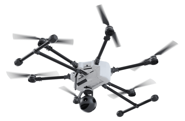
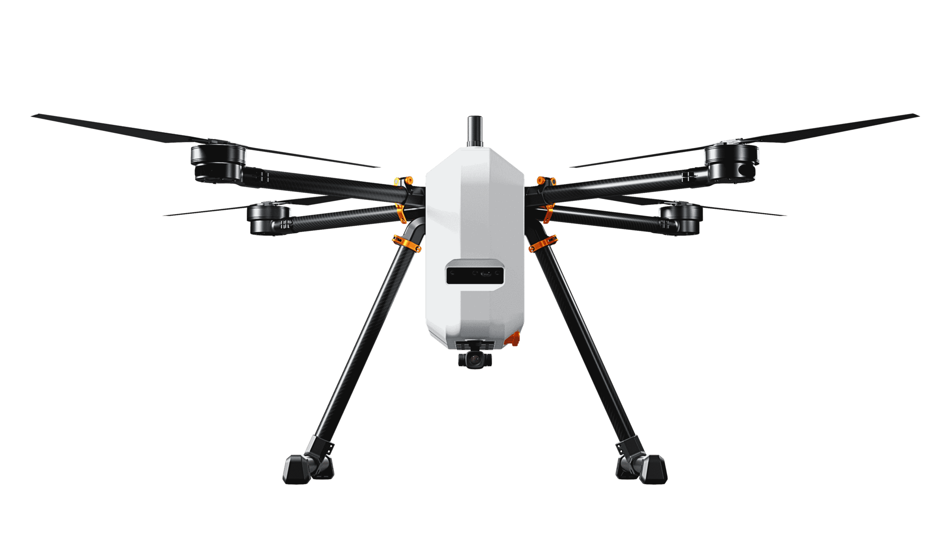
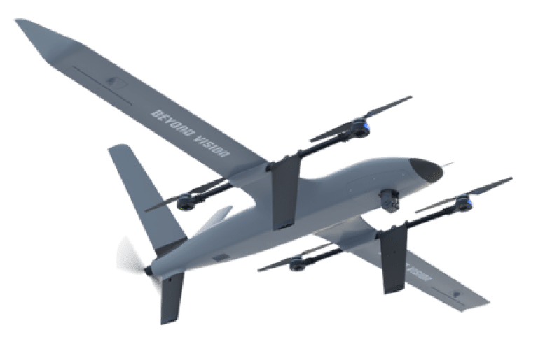
El futuro de la cartografía multiespectral es brillante. El objetivo de los investigadores es perfeccionar los algoritmos de procesamiento de datos e integrar el aprendizaje automático para la detección automática de características. Y lo que es más importante, se pretende explorar diversas fuentes de datos como LiDAR y SAR equipadas con HEIFU pro o VTOne VTOL eléctrico de largo alcance. Estos avances podrían revolucionar la vigilancia medioambiental, la respuesta ante catástrofes y la investigación sobre el cambio climático. Imagínese conocimientos más profundos y soluciones más eficaces a los retos mundiales.
- Compartir esta publicación