


Que sont les cartes multispectrales 2D et 3D et pourquoi sont-elles si précieuses ?
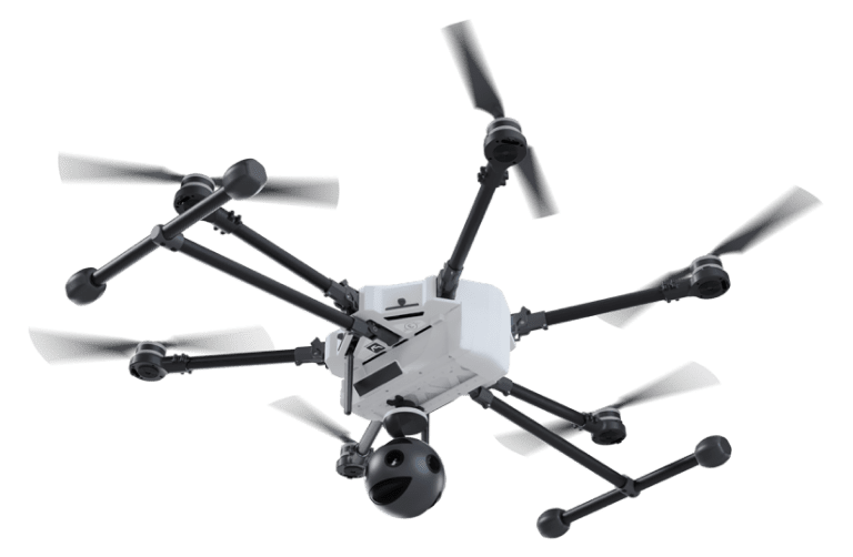
Les cartes multispectrales 2D et 3D sont un moyen avancé de capturer des données au-delà de la vision humaine, offrant des vues détaillées de la surface de la Terre. Des caméras spécialisées collectent des images dans différentes longueurs d'onde, notamment dans l'infrarouge et le proche infrarouge, révélant ainsi des détails invisibles à l'œil nu. Ces détails, comme une végétation saine ou des variations de chaleur, sont capturés parce que chaque bande spectrale cible des éléments spécifiques au sol. Grâce à des processus sophistiqués tels que la collecte de données aériennes et la modélisation numérique, les cartes multispectrales sont devenues des outils puissants pour la science, la gestion des ressources et la politique. Elles comblent le fossé entre ce que nous voyons et les modèles cachés de notre environnement, ce qui représente un saut technologique important dans la compréhension de notre planète. L'avantage principal est une perspective à plusieurs niveaux, offrant des perspectives invisibles à l'œil nu. Cette technologie puissante est essentielle pour de nombreux domaines. Dans le domaine de la santé, la technologie de l'information est essentielle pour de nombreux domaines. l'agriculturePour la protection de l'environnement, il aide les agriculteurs à surveiller la santé de leurs cultures et à utiliser l'eau plus efficacement. Dans le domaine de la protection de l'environnement, elle nous permet de suivre la déforestation et de protéger nos forêts. En matière d'urbanisme, il permet d'identifier les zones qui retiennent la chaleur et d'orienter le développement durable.
Efforts antérieurs, limites et évolution de la photogrammétrie et de la télédétection
Le domaine de la photogrammétrie et de la télédétection joue depuis longtemps un rôle essentiel dans la cartographie et l'analyse de la surface de la Terre. Les méthodes traditionnelles s'appuient principalement sur des techniques photographiques directes et sur l'imagerie satellitaire de base pour recueillir des informations spatiales. Les méthodes existantes ont jeté les bases des applications environnementales, mais elles peinent à capturer les détails complexes nécessaires à une analyse approfondie. Cela entrave notre capacité à comprendre pleinement les questions environnementales complexes.
Progrès dans les méthodologies : SfM et MVS
- Limitation spectrale - Les méthodes photographiques conventionnelles capturent principalement des images dans le spectre visible, ce qui limite la gamme des variables environnementales détectables. De nombreux signes cruciaux de la santé de l'environnement, comme le stress des plantes, deviennent plus clairs lorsque nous regardons au-delà de la lumière visible. Ces signes sont souvent révélés dans des longueurs d'onde non visibles, telles que l'infrarouge ou l'ultraviolet, que nos yeux ne peuvent pas détecter.
- Résolution spatiale - Les missions satellitaires antérieures fournissaient souvent des images satellitaires à faible résolution spatiale, ce qui posait des problèmes pour la détection des changements environnementaux à petite échelle. Cette limitation entrave notre capacité à détecter activement les changements environnementaux subtils. Il est également difficile de cartographier avec précision les petites caractéristiques. Ces capacités sont essentielles à la fois pour la gestion détaillée de l'environnement et pour la recherche scientifique.
- Résolution temporelle - La fréquence à laquelle les images satellites traditionnelles sont capturées peut être insuffisante pour surveiller les changements environnementaux rapides. Ce retard peut entraver l'analyse et la réaction en temps voulu à des événements tels que les catastrophes naturelles, les changements saisonniers ou le développement urbain rapide.
- Dimensionnalité - Les méthodes photographiques directes et l'imagerie satellitaire de base sont limitées dans leur capacité à capturer la structure tridimensionnelle des paysages et des objets. Cette limitation restreint la profondeur d'analyse possible, en particulier dans des applications telles que la sylviculture, l'urbanisme et les études géomorphologiques.
Limites des méthodes traditionnelles
Les limites des méthodes traditionnelles ont été reconnues. La communauté scientifique a réagi en adoptant SfM et MVS - des méthodologies plus sophistiquées. Ces avancées permettent d'améliorer considérablement la qualité et l'utilité des données spatiales.
- Structure from Motion (SfM) - SfM est une technique photogrammétrique qui permet de construire des structures tridimensionnelles à partir de séquences d'images bidimensionnelles. En analysant plusieurs photographies prises à partir de différents points de vue, les algorithmes SfM peuvent déduire les coordonnées tridimensionnelles des points de la surface photographiée. Cette méthode permet non seulement d'améliorer la résolution spatiale, mais aussi d'introduire la dimensionnalité manquante dans les méthodes traditionnelles, ce qui permet de créer des modèles 3D détaillés de l'environnement.
- Stéréopsis multi-vues (MVS) - S'appuyant sur les principes du SfM, la stéréopsie multi-vues affine encore le processus de génération de modèles 3D en utilisant des images capturées sous plusieurs angles pour reconstruire une scène. Les techniques MVS se concentrent sur l'analyse de la disparité entre les images prises à partir de différents points de vue pour estimer la profondeur, ce qui améliore considérablement la précision et le détail des modèles 3D produits.
Le SfM et le MVS représentent tous deux des avancées significatives dans notre capacité à générer des cartes et des modèles multidimensionnels précis et à haute résolution de la surface de la Terre. Les nouvelles méthodologies permettent de surmonter les nombreuses limites des techniques traditionnelles de photogrammétrie et de télédétection. Ces progrès ouvrent de nouvelles possibilités d'analyse approfondie de l'environnement. Grâce à ces méthodes, les scientifiques et les chercheurs peuvent désormais explorer et comprendre la dynamique complexe des environnements naturels et bâtis. Le résultat ? Une clarté et un niveau de détail sans précédent.
Méthodologie de génération de cartes multispectrales
La génération de cartes multispectrales 2D et 3D repose sur une méthodologie soigneusement structurée. Cette méthode implique tout d'abord une série de procédures. Ces procédures intègrent de manière transparente des techniques d'imagerie avancées et un traitement sophistiqué des données. En fin de compte, ce processus traduit l'imagerie aérienne en représentations détaillées et multidimensionnelles de la surface de la Terre. En voici les étapes :
Chargement/entrée des données
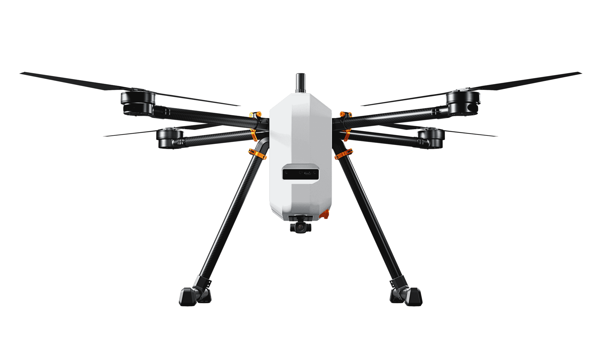
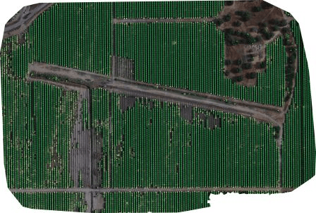
Les plateformes aéroportées équipées de capteurs d'imagerie collectent des images aériennes. Ces images constituent la première étape cruciale de la création de cartes multispectrales 2D et 3D, qui capturent la surface de la Terre dans ses moindres détails. Cette étape permet de recueillir des données brutes, qui constituent la base de toutes les analyses et modélisations ultérieures.
Structure from Motion (SfM)
Le passage de la phase de chargement/entrée des données à l'étape de la structure à partir du mouvement (SfM) dans la création de cartes multispectrales est une progression transparente qui repose sur la préparation et l'organisation systématique des images aériennes collectées. Cette transition est facilitée par une série d'actions et d'analyses interconnectées qui préparent le jeu de données pour une modélisation 3D complexe.
- Extraction des métadonnées - Il s'agit de l'étape initiale de SfM, au cours de laquelle les métadonnées pertinentes (par exemple, les coordonnées GPS, l'orientation de la caméra) sont extraites de chaque image. Ces informations sont cruciales pour un positionnement et une orientation précis dans le processus de reconstruction qui suit.
- Détection des caractéristiques - Des algorithmes sont utilisés pour détecter des caractéristiques visuelles distinctes dans les images, telles que des bords ou des textures spécifiques, qui sont essentielles pour la mise en correspondance et le suivi de plusieurs images.
- Correspondance des caractéristiques - Cette étape consiste à identifier et à associer des caractéristiques similaires détectées sur différentes images. Une mise en correspondance réussie des caractéristiques est essentielle pour reconstruire avec précision la scène en 3D.
- Création de pistes - Il s'agit de développer des séquences ou des "pistes" de caractéristiques correspondantes sur plusieurs images. Ces traces aident à comprendre le mouvement et la structure de la scène et servent de guide pour le processus de reconstruction en 3D.
- Reconstruction - En utilisant les pistes de caractéristiques comme références, un modèle 3D peu dense de la scène est assemblé. Ce modèle représente la reconstruction initiale, moins dense, de la géométrie de la scène.
- Déformation - Avant la densification, toutes les distorsions présentes dans les images (généralement causées par l'objectif de l'appareil photo) sont corrigées. Cette étape permet de s'assurer que les images reflètent fidèlement la forme et la taille réelles des objets de la scène.
Stéréo multi-vues (MVS)
- Sélection des paires stéréo - Dans le processus MVS, les paires d'images sont sélectionnées en fonction de leur pertinence pour l'analyse de la profondeur. Cette sélection est guidée par le chevauchement et les angles entre les images afin de maximiser l'extraction d'informations sur la profondeur.
- Estimation de la carte des profondeurs - Pour chaque paire (ou ensemble) d'images sélectionnée, des cartes de profondeur sont estimées, détaillant la distance des surfaces du point de vue de la caméra.
- Filtrage des cartes de profondeur - Les cartes de profondeur estimées sont filtrées afin d'éliminer le bruit et d'améliorer la précision, ce qui permet de ne conserver que des informations fiables sur la profondeur.
- Fusion des cartes de profondeur - Les cartes de profondeur affinées provenant de plusieurs vues sont ensuite fusionnées en un modèle de profondeur unique et cohérent. Ce modèle fournit une représentation plus détaillée et plus précise de la géométrie de la scène.
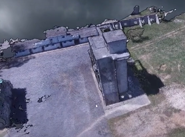
Reconstruction du maillage
Après le processus MVS, la transformation détaillée des définitions des fonctions spatiales jusqu'à l'extraction des isosurfaces a lieu. Cette étape crée une représentation maillée du modèle, en ajoutant des détails de surface et des textures au modèle de profondeur précédemment construit.
Les processus SfM et MVS, ainsi que la reconstruction par maillage, créent ensemble un flux de travail qui transforme des séries d'images aériennes en modèles 3D détaillés et texturés. Cette approche combine deux types d'informations pour créer des reconstructions de scènes très précises. Elle utilise des données géométriques provenant d'images individuelles et des données de profondeur obtenues en analysant des paires d'images.
Reconstruction du maillage
Après le processus MVS, la transformation détaillée des définitions des fonctions spatiales jusqu'à l'extraction des isosurfaces a lieu. Cette étape crée une représentation maillée du modèle, en ajoutant des détails de surface et des textures au modèle de profondeur précédemment construit.
Les processus SfM et MVS, ainsi que la reconstruction par maillage, créent ensemble un flux de travail qui transforme des séries d'images aériennes en modèles 3D détaillés et texturés. Cette méthode avancée combine les formes des images individuelles avec les données de profondeur des paires d'images. Il en résulte des modèles 3D incroyablement précis de la scène photographiée.

Reconstruction des textures
Après la création d'un modèle 3D par SfM, MVS et la reconstruction du maillage, la reconstruction de la texture est le processus qui donne vie au modèle en ajoutant des détails de surface réalistes.
- Prétraitement - Après la création d'un modèle 3D par SfM, MVS et la reconstruction du maillage, la reconstruction de la texture est le processus qui donne vie au modèle en ajoutant des détails de surface réalistes.
- Voir la sélection -Détermine les images ou les perspectives les plus appropriées pour appliquer les textures au modèle 3D. Cette étape est cruciale pour optimiser la qualité visuelle du modèle, en veillant à ce que les textures soient appliquées sous des angles qui minimisent les distorsions et couvrent le modèle de manière uniforme.
- Ajustement des couleurs - Affiner les couleurs des textures dérivées des images aériennes pour qu'elles correspondent à l'aspect réel du terrain et des caractéristiques. Cette étape permet de corriger les écarts de couleur qui peuvent résulter des conditions d'éclairage ou des réglages de l'appareil photo au cours du processus d'acquisition des images, ce qui améliore le réalisme du modèle texturé.
Géoréférencement
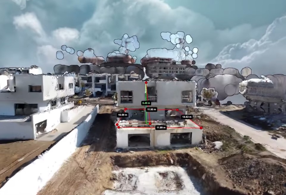
Le géoréférencement consiste à aligner le modèle 3D texturé sur les coordonnées géographiques réelles, ce qui est essentiel pour garantir que le modèle représente avec précision l'emplacement physique et l'orientation de la zone étudiée.
L'alignement du modèle garantit qu'il correspond aux emplacements réels, ce qui le rend compatible avec d'autres données géographiques. Cela libère son potentiel pour des utilisations pratiques telles que la planification urbaine, la surveillance de l'environnement et la navigation.
Création d'une orthomap
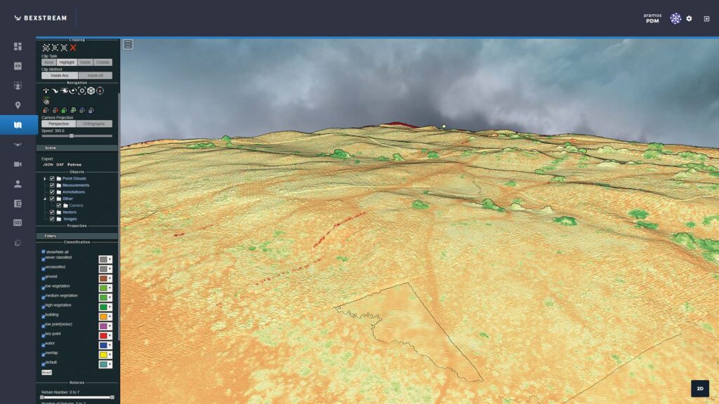
- Orthomap - Fournit une vue aérienne de la zone étudiée, en aplatissant le modèle 3D en une carte 2D tout en conservant la précision spatiale des caractéristiques. Cette carte est utile pour un large éventail d'applications nécessitant une imagerie précise et descendante, telles que l'aménagement du territoire, la gestion des actifs et l'analyse géographique.
Résultats expérimentaux : Applications pratiques et défis
La méthode décrite pour les cartes multispectrales 2D et 3D, utilisant des données RVB, multispectrales et thermiques, a montré des améliorations majeures dans la surveillance de l'environnement, l'agriculture et la planification urbaine. L'application d'un processus complet de collecte de données, de SfM, de MVS, de texturation et de géoréférencement a permis de produire des modèles de paysage détaillés et précis. Ces modèles servent à de multiples fins, de l'évaluation de la santé des cultures et des besoins en irrigation dans l'agriculture à l'amélioration des études sur les îlots de chaleur urbains et les efforts de conservation de l'environnement.
Défis rencontrés et solutions
Nous avons rencontré des difficultés lors de l'application de cette méthodologie. Il s'agissait notamment de traiter la quantité massive de données, d'assurer la précision des modèles 3D et de gérer les complexités de l'imagerie thermique. Vous trouverez ci-dessous une analyse de ces défis et des solutions mises en œuvre pour les relever :
Volume de données et temps de traitement :
Défi : Les images aériennes à haute résolution pour les cartes détaillées en 2D et en 3D nécessitent une quantité massive de données. La puissance de traitement des ordinateurs est donc mise à rude épreuve, ce qui entraîne de longs délais d'attente pour la création des cartes.
Solution : Des techniques d'optimisation ont été appliquées pour rationaliser le traitement des données, y compris le traitement parallèle et les ressources informatiques en nuage. En outre, des algorithmes ont été affinés pour gérer et traiter efficacement de grands ensembles de données, réduisant ainsi le temps nécessaire à la génération de modèles.
Précision des modèles 3D :
Défi : Garantir la précision spatiale des modèles 3D, en particulier dans des environnements complexes avec un terrain et une végétation variés, s'est avéré être un obstacle de taille.
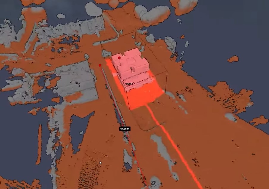
Solution : Des méthodes d'étalonnage améliorées et des algorithmes avancés de mise en correspondance des caractéristiques ont été utilisés pour améliorer la précision des reconstructions 3D. L'intégration de points de contrôle au sol (GCP) et la validation rigoureuse du post-traitement ont également contribué à atteindre des niveaux élevés de précision du modèle.
Intégration de l'imagerie thermique :
Défi : L'intégration de l'imagerie thermique dans le processus de cartographie multispectrale s'est avérée difficile en raison du faible contraste et de la nature sans caractéristiques des images thermiques, ce qui rend difficile la détection et la mise en correspondance des caractéristiques.
Solution : Pour améliorer la visibilité des caractéristiques dans les images thermiques, par exemple dans le cas de notre gestion durable des ressources viticoles Nous avons mis au point des étapes de prétraitement spécialisées. Nous avons ensuite adopté une approche hybride, combinant les données thermiques avec des images RVB et multispectrales afin de maximiser les points forts de chaque type. Cette approche nous a permis d'intégrer avec succès des informations thermiques dans des cartes multispectrales, révélant des informations précieuses sur les variations de température et les sources de chaleur.
Conditions environnementales et variabilité de l'éclairage :
Défi : Des conditions d'éclairage variables et des facteurs environnementaux tels que la couverture nuageuse et les ombres ont affecté la cohérence et la qualité des images aériennes.
Solution : Une planification stratégique des missions de collecte de données a été mise en œuvre pour coïncider avec des conditions d'éclairage et météorologiques optimales. Lorsque des incohérences étaient inévitables, des techniques avancées de traitement d'images, notamment l'étalonnage radiométrique et la compensation des ombres, ont été appliquées pour normaliser les données.
Implications des résultats expérimentaux
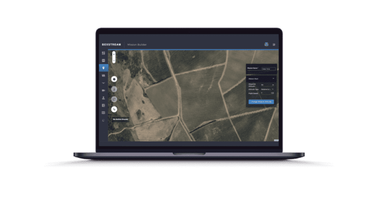
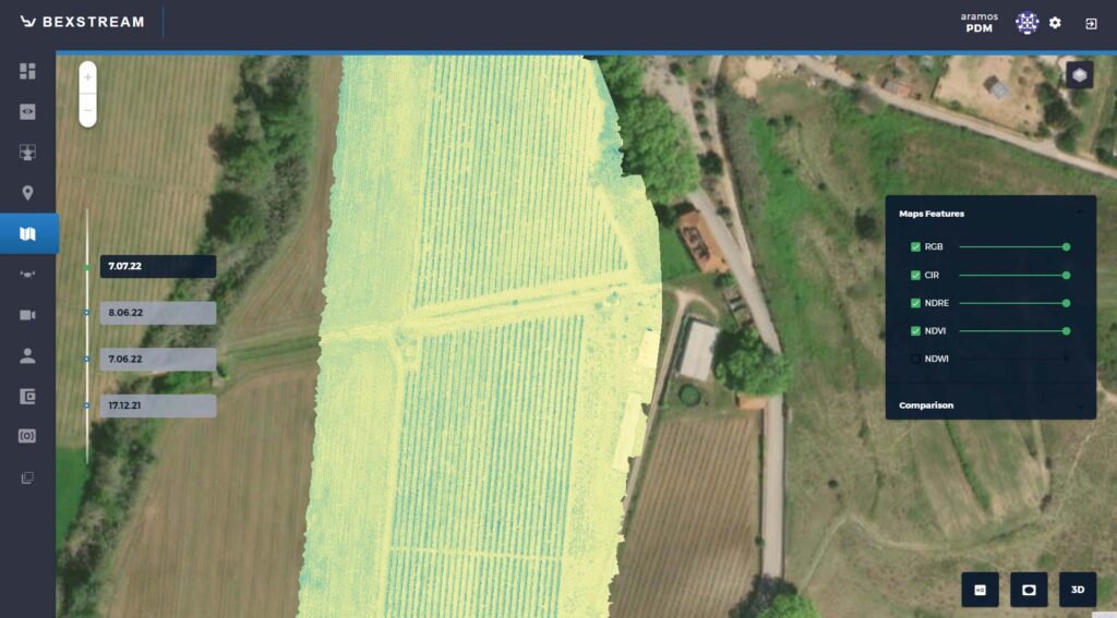
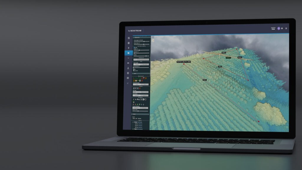
Des expériences mettent en évidence la puissance des cartes multispectrales pour comprendre notre monde. Ces données détaillées, acquises grâce à des techniques avancées, ouvrent des portes à l'analyse environnementale, à l'optimisation de l'agriculture et à la planification urbaine durable. En capturant au-delà du spectre visible, ces cartes révèlent des informations cruciales pour la surveillance des écosystèmes, la gestion de l'eau et la planification de villes durables. La polyvalence de ces cartes, capturées à l'aide de la technologie beXStream La commande à distance de drones basée sur le cloud, souligne leur valeur dans divers domaines, de la détection de changements subtils dans la végétation à l'identification des signatures thermiques dans les zones urbaines.
Efficacité des méthodes adoptées
Les méthodologies employées dans cette étude, en particulier celles adaptées du flux de travail d'OpenDroneMap, se sont avérées très efficaces pour générer des cartes multispectrales précises et détaillées. L'intégration des techniques SfM (Structure from Motion) et MVS (Multi-View Stereo), ainsi que des processus avancés de texturation et de géoréférencement, ont facilité la création de modèles 3D à haute résolution à partir d'images aériennes. L'application réussie de ces méthodologies souligne l'importance d'une approche globale et intégrée du traitement des données en télédétection. En exploitant les outils open-source d'OpenDroneMap, l'étude a bénéficié d'une plateforme robuste et soutenue par la communauté, permettant le traitement efficace de grands ensembles de données et la production de modèles spatiaux très détaillés. Cette validation du flux de travail d'OpenDroneMap dans le contexte de la cartographie multispectrale souligne son potentiel en tant qu'outil précieux pour les chercheurs et les professionnels dans ce domaine.
Orientations futures de la recherche et des applications
Le domaine de la cartographie aérienne multispectrale est prêt à faire des percées. Les recherches futures pourraient affiner les algorithmes de traitement des données, en particulier pour les projets à grande échelle, afin d'augmenter la vitesse et la précision de la génération de modèles. En outre, l'intégration de l'apprentissage automatique et de l'IA pourrait offrir de nouvelles méthodes de détection et de classification des caractéristiques, ce qui permettrait d'automatiser certaines parties du processus et de révéler des modèles cachés. En outre, l'exploration de diverses sources de données telles que les données LiDAR et SAR pourrait améliorer les capacités d'analyse multidimensionnelle des cartes multispectrales 2D et 3D. Du côté des applications, la cartographie multispectrale offre un vaste potentiel pour contribuer à la recherche sur le changement climatique, à la planification de la réponse aux catastrophes et à la conservation de la biodiversité, parmi d'autres défis mondiaux urgents. L'évolution des technologies et des méthodologies s'accompagnera d'une évolution de leurs applications, promettant des connaissances plus riches et des solutions plus efficaces pour divers problèmes environnementaux et sociétaux.
Points clés
-
Importance de la prévention des collisions
- Les cartes multispectrales sont des outils avancés qui capturent des données sur plusieurs longueurs d'onde, révélant des détails complexes sur la surface de la Terre, invisibles à l'œil nu.
- Leur valeur réside dans des applications telles que la gestion agricole, la conservation de l'environnement et la planification urbaine. -
Limitations of Traditional Photogrammetry & Remote Sensing
- Les méthodes traditionnelles étaient limitées par la résolution spectrale, spatiale et temporelle, ainsi que par la dimensionnalité, ce qui affectait la profondeur de l'analyse environnementale.
-
Progrès dans les méthodologies - SfM et MVS
- Les méthodologies SfM (Structure from Motion) et MVS (Multi-View Stereopsis) offrent des améliorations significatives dans la génération de modèles 3D précis et de haute résolution. -
Méthodologie de génération de cartes multispectrales
- Le processus comprend la collecte de données, le SfM pour la modélisation 3D, le MVS pour l'analyse de la profondeur, la reconstruction du maillage pour la création d'une représentation maillée et la reconstruction de la texture pour l'ajout de détails de surface. -
Experimental Results & Challenges
- Les applications dans le domaine de la surveillance de l'environnement, de l'agriculture et de la planification urbaine ont été mises en évidence, ainsi que les défis tels que le volume de données, la précision du modèle, l'intégration de l'imagerie thermique et la variabilité de l'état de l'environnement... -
Implications des résultats expérimentaux
- Les cartes multispectrales améliorent la compréhension du monde physique, avec des applications polyvalentes dans divers domaines. -
Efficacité des méthodes adoptées
- Les méthodologies, en particulier celles adaptées d'OpenDroneMap, se sont avérées efficaces pour produire des cartes multispectrales détaillées. -
Orientations futures de la recherche et des applications
- Les domaines potentiels comprennent l'affinement des algorithmes de traitement des données, l'intégration de l'apprentissage automatique et l'extension de l'utilisation de diverses sources de données pour des applications plus larges.
Questions liées
Les cartes multispectrales capturent des données sur plusieurs longueurs d'onde, révélant des détails sur la santé des cultures, l'humidité du sol et les besoins d'irrigation. Ces informations sont d'une valeur inestimable pour l'agriculture, car elles permettent aux agriculteurs de surveiller avec précision les cultures et d'optimiser les pratiques. En savoir plus sur les cartes multispectrales l'agriculture de précision.
Les méthodes traditionnelles de télédétection étaient limitées par leur résolution spectrale, spatiale et temporelle, ainsi que par leur manque de dimensionnalité. Ces limitations restreignent la profondeur et la précision des analyses environnementales, rendant difficile la saisie des détails nuancés nécessaires à des études approfondies. beXStream facilite l'acquisition et l'analyse des données.
La structure à partir du mouvement (SfM) et la stéréopsie multi-vues (MVS) améliorent considérablement la résolution et la précision des modèles 3D en analysant plusieurs photographies à partir de différents points de vue. Cela permet la reconstruction détaillée de la surface de la Terre en trois dimensions, en capturant des détails complexes qui étaient auparavant impossibles à obtenir.
La génération d'une carte multispectrale implique plusieurs étapes clés : la collecte d'images aériennes, suivie de la structure à partir du mouvement (SfM) pour la modélisation 3D, de la stéréoscopie multi-vues (MVS) pour l'analyse de la profondeur, de la reconstruction du maillage pour créer une représentation maillée et, enfin, de la reconstruction de la texture pour ajouter des détails de surface réalistes au modèle.
Les principaux défis posés par l'intégration de l'imagerie thermique sont le faible contraste et l'absence de caractéristiques distinctes dans les images thermiques, ce qui rend difficile la détection et la mise en correspondance des caractéristiques. Les chercheurs ont relevé ces défis en développant d'abord des étapes de prétraitement spécialisées. Ces étapes ont permis d'améliorer la visibilité des caractéristiques dans les données. Ils ont ensuite utilisé une approche hybride. Cette approche combine les données thermiques avec des images RVB et multispectrales pour une meilleure intégration.
Les cartes multispectrales contribuent de manière significative à la planification urbaine et à la conservation de l'environnement en fournissant des informations détaillées sur la santé de la végétation, le stress hydrique et les îlots de chaleur urbains. Ces informations soutiennent les pratiques de développement durable, les efforts de conservation de la biodiversité et la gestion efficace des ressources.
L'adoption du flux de travail d'OpenDroneMap a eu un impact positif sur la production de cartes multispectrales en offrant une plateforme efficace, robuste et soutenue par la communauté pour le traitement de grands ensembles de données. Cela a permis de créer des modèles spatiaux détaillés avec une précision et une résolution accrues.
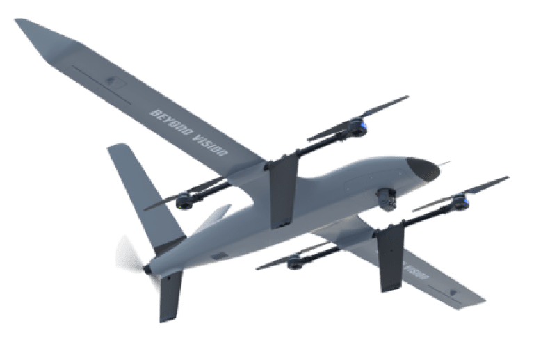
L'avenir de la cartographie multispectrale est prometteur ! Les chercheurs cherchent à affiner les algorithmes de traitement des données et à intégrer l'apprentissage automatique pour la détection automatisée des caractéristiques. Plus important encore, il s'agit d'explorer diverses sources de données, telles que LiDAR et SAR, équipées d'un système d'imagerie multispectrale. HEIFU pro ou VTOne VTOL électrique à longue portée. Ces avancées pourraient révolutionner la surveillance de l'environnement, les interventions en cas de catastrophe et la recherche sur le changement climatique. Imaginez des connaissances plus riches et des solutions plus efficaces pour relever les défis mondiaux !
- Partager cette publication